
Choice of itinerary and stages
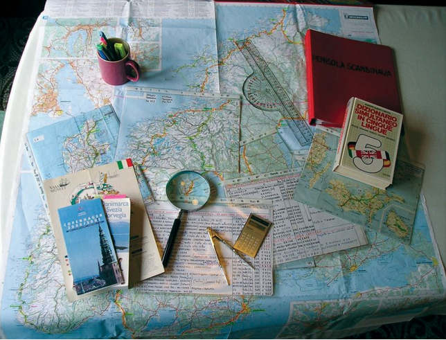
The definition of the routes and stages of our Way required a work of historical reconstruction, which took into account the physical practicability, the ownership of the land crossed and the accommodation facilities offering refreshment possibilities.
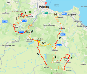
This has resulted in a project that includes two variants: in the first, the more extensive one (LONGEST ROUTE) shown below, the Way is distributed in ten stages (the sheets for each stage are numbered from 1 to 10) in relation to the difficulty of the routes and the availability of accommodation facilities.
The second variant (Short Route), which is shown below, is divided into seven stages. It shares the first four stages and the last two with the first variant. On the fifth stage (Stage 5/8), instead of continuing to Ficuzza, it cuts and goes directly to Marineo.
Download the GPS track
Download the GPS track
The stages we have planned are, however, indicative because they take into account the average ability of walkers and disregard the varied propensities of different individuals.
Each person can construct his or her own stages according to his or her abilities, interests and time availability.
Someone’s way may include only a few stages, or they may cover two stages in a single day; they may allow themselves periods of rest, or provide for additional excursions in the surrounding area.
But be careful, however, the planning of the stages must be carried out with great care, especially with regard to the accommodation facilities: missing an opportunity may mean having to cover many additional kilometres.
In the height profiles of the various stages, which give a more immediate perception of the progress of the route, accommodation facilities will be indicated.

CAPTION AND SYMBOLS
For each stage you will find, in addition to descriptive information highlighting specific critical points, a map of the area in which the stage itself falls and an altitude profile
In the profile, in addition to prominent points such as towns or accommodation facilities, the type of route is also indicated using the following symbolism:


Other data are also provided below the map of each route:
L length of the stage – DS total height difference in ascent – DD total height difference in descent – Qmax maximum height of the stage – Qmin minimum height of the stage – DIFF difficulty
SIGNAGE, GPS AND WIKILOC
It has not yet been possible to install adequate signposting throughout the route to guide walkers. The installation of signposts has been started with priority given to sections where even the GPS track does not give clear indications. So you will often find the characteristic red and green arrows or simple red and green markings to guide you, but you cannot rely on them alone.
At this stage you will need to use the GPS tracks that you can download from the site and use them with any GPS or your smartphone.
You do not need to have a professional GPS, just a simple mobile phone with a battery that is not near the end of its life cycle.
For less than 10 euros, for example, the Wikiloc app has the advantage that it uses very little energy and does not require constant monitoring of the route: once started, if we are leaving the route, it alerts us with an acoustic signal. But there are many other similar apps.
The Wikiloc app can be downloaded from https://it.wikiloc.com/: there is also a free version, but it only works if the mobile phone is connected to the network and in some mountain areas we do not have this guarantee
The premium version allows you to download Google maps of the area and also works offline, as well as offering various other search opportunities.
Open the app and select ‘explore’ and under ‘find routes’ enter Mille860. Then choose “With the text Mille860”. The app will give you a list of all stages of the route as well as the complete route and the short route.

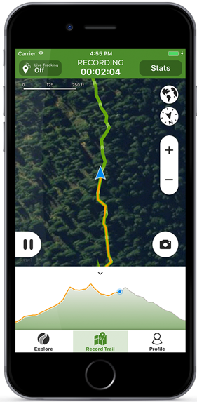
Select what you need. You can choose the complete route, which gives you the possibility to follow the Way from any starting point, but beware, there are no waypoints indicating points of interest and accommodation along the route or nearby.
Once you have selected the route you have to download it to have it on your mobile phone even offline, when there is no reception and you cannot connect to the internet. To complete the operation, the app will ask you to subscribe to a premium subscription. Follow the procedure to subscribe and download.
The app also suggests you to download offline maps, follow its directions.
When you start up, all you have to do is open the app, choose the route you downloaded first and select the “follow route” option: even if you are not on the Way, it will guide you to get there by the shortest route.
If you have never used this app practice a bit in your area, Wikiloc has over 20 million routes worldwide and uses very little energy to track them or to check if you are not going wrong. If you use the ‘follow route‘ option the app will record your track, you can also add photos and waypoints. In that case it draws a lot more energy and it becomes essential to have a power bank to recharge the battery and not be left without guidance